Routing and routing options
Was this helpful?
Was this helpful?
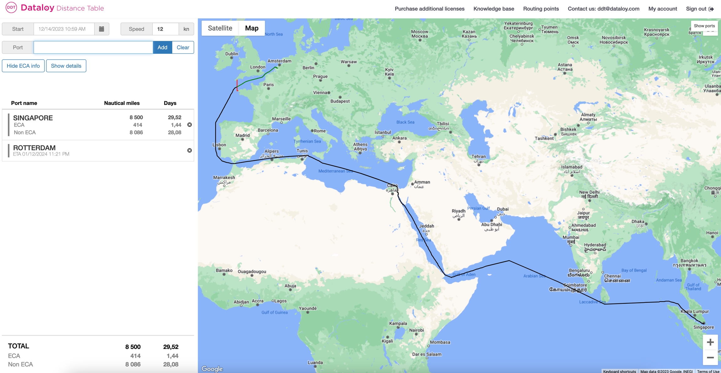
The routes in Dataloy Distances are, by default, the shortest route viable for a commercial ship. As ships have varying sizes, route customisation is essential to get the most accurate route for your needs.
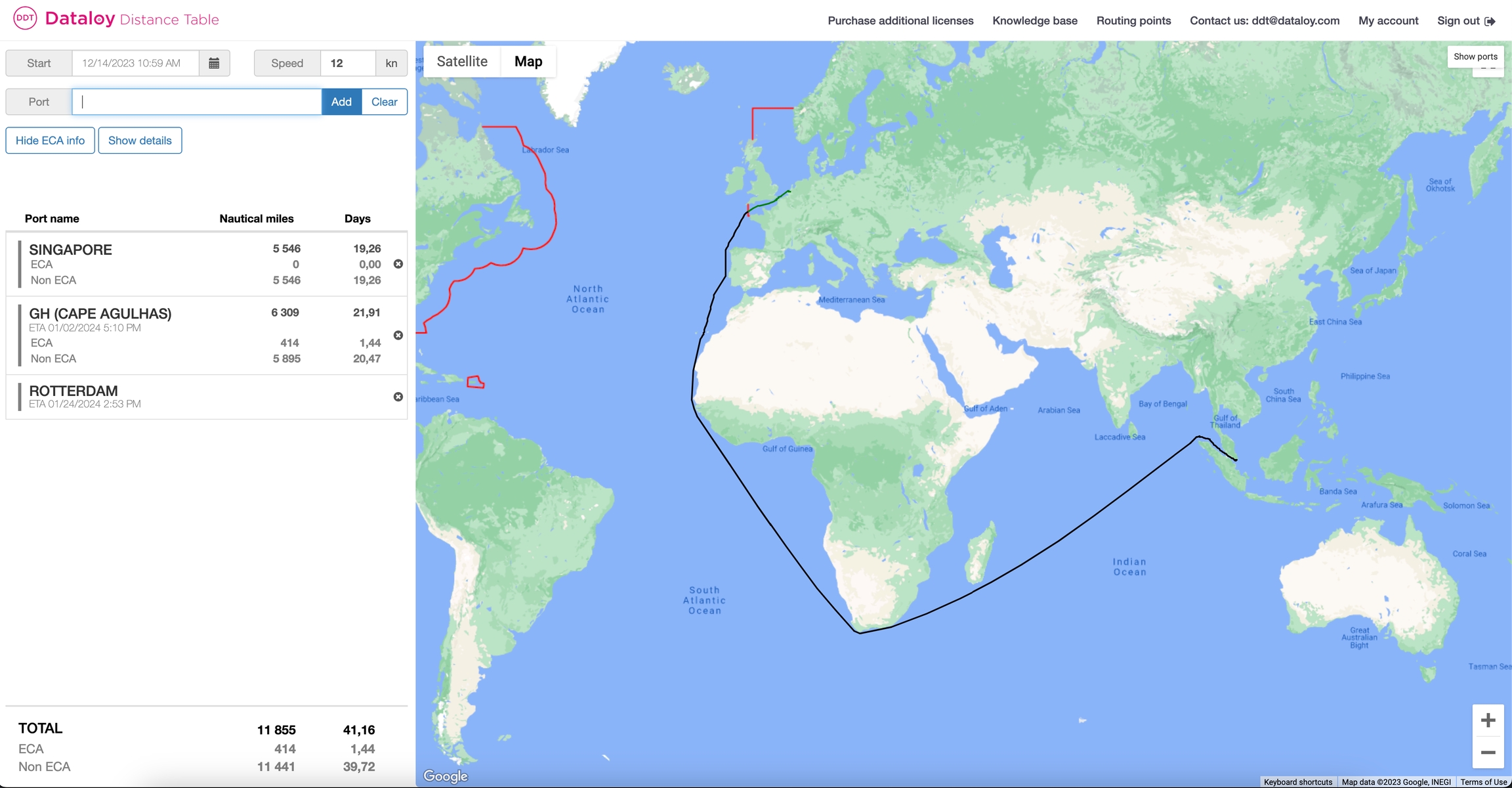
The routes can be customised by adding additional ports, routing points, and canals. It is also possible to add points using latitude and longitudes of your choice.
To Search for/Add a Routing Point/Port
Routing point searches can be performed in two ways: in the search field or by using a map.
Locate the applicable routing point on the map.
An information pop-up opens, providing the routing point/port name and/or code and details.
Enter the routing point name or code in the search field to the left.
A drop-down list of ports will be displayed.
From the list, either
click the applicable routing point/port or
when the routing point/port is at the top of the list, press the Tab key - the routing point/port name will display in full in the search field or
use the down-arrow to select applicable routing point/port - it will highlight.
Click Add or press Enter. The routing point/port is added to the route. Note: Drag the newly added routing point to the correct place in the port rotation (list of ports)
Ensure the route is updated accordingly.
The Dataloy Distance Table has several routing points for directing a sailing route outside piracy/war risk and ECA areas:
Common Routing Points:
PC (Panama Canal)
SC (Suez Canal)
GH (Cape Good Hope)
MA (Magellan Strait)
CH (Cape Horn)
TO (Torres Strait)
WP (Wilsons Promontory)
SS (Singapore Strait)
SU (Sunda Strait)
NE (North East Passage)
NW (North West Passage)
KC (Kiel Canal)
TS (Tsugaru Strait)
OS (Osumi Strait)
LS (Lombok Strait)
OR (Oresund)
GB Great Belt)
PF (Pentland Firth)
DS (Dover Strait)
BR (Bishop Rock)
BI (Belle Isle)
CR (Cape Race)
WI (Windward Passage)
MP (Mona Passage)
AP (Anegada Passage)
PR (Providence Canal)
VP (Virgin Passage)
BL (Balabac Strait)
BS (Basilan Strait)
SG (Surigao Strait)
SB (San Bernardino Strait)
SJ (Selat Jailolo)
CC (Corinth Canal)
JE (Jomard Entrance)
OM (Selat Ombai)
JS (Johnstone Strait)
GV (Grenville Channel)
NP (Nanuku Passage)
CO (Cook Strait)
Click the "Show Ports" button to show all routing points/ports on the map. The ports will show according to zoom level, so you might need to zoom in to display smaller ports.
Click on or hover over (with the cursor) the applicable routing point symbol .


