
Positions
Feature available on request.
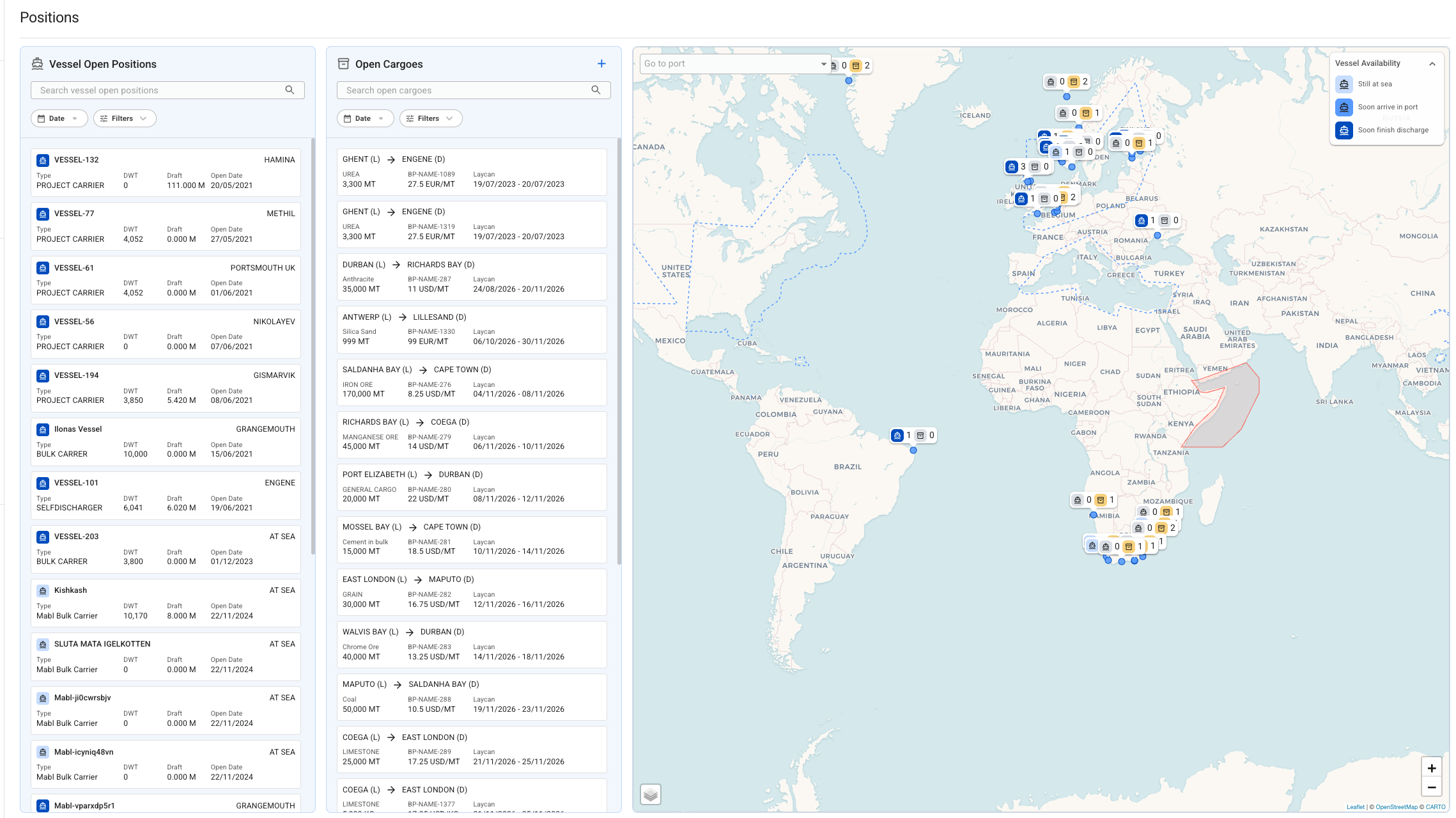
Positions is an interactive map and planning surface for managing vessel and cargo exposure. It gives you a single view of every open vessel and every unallocated cargo, plotted geographically, so you can spot coverage gaps and create voyage estimations without leaving the page.
Positions is a planning and execution tool grounded in your VMS data. Vessels and cargoes shown here always come from real fleet and cargo records, not a general market feed.
Was this helpful?